Due to the size and complexity of the St. Louis public transportation system, maintaining a consistent brand is one of the many challenges facing Metro Transit. Often resources are gathered from multiple designers, across several agencies, at various points in time. Seen here are three different directional maps.
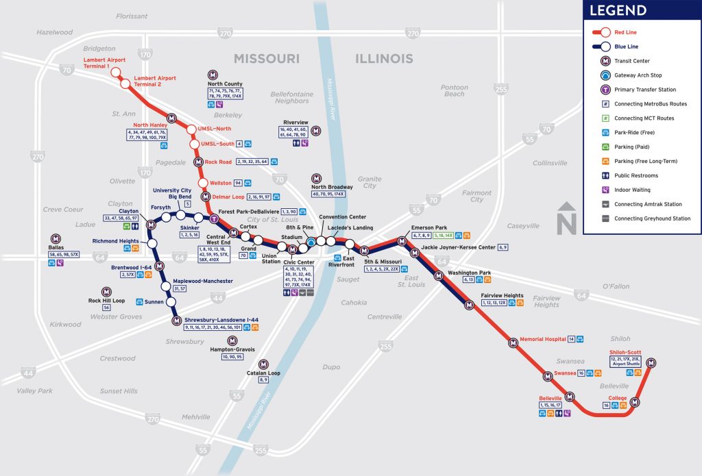
MetroLink Alignment Map: A multipurpose resource for transit riders. It illustrates connecting bus routes from 38 different light rail stations, and highlights amenities provided at each facility.
MetroBus Maps: These provide specific directional information, including popular destinations, along individual bus service routes.
Rider Alert Maps: Often created when street construction or other unforeseen events impact riders who depend on Metro Transit for their daily commute.
Bus Bay Maps
Navigating the bi-state region via public transportation can be a challenge, but it all starts with catching the right bus. These maps simplify the process for riders who may be unfamiliar with the transit facilities of Metro St. Louis.
Metro Reimagined Maps
Metro Transit received input from the public, riders, community groups and elected officials and incorporated that feedback into the new MetroBus network plan. Seen here are a set of maps that split bus coverage into four service tiers. Frequent, Local, Express, and Community. This paved the way for Metro’s biggest service change in over 20 years.


Leave a Reply